Forecast check ·
Cloud inversions in the Highlands: 14 July 2026
Torridon, Loch Quoich and Tap o’ Noth
The quick answer
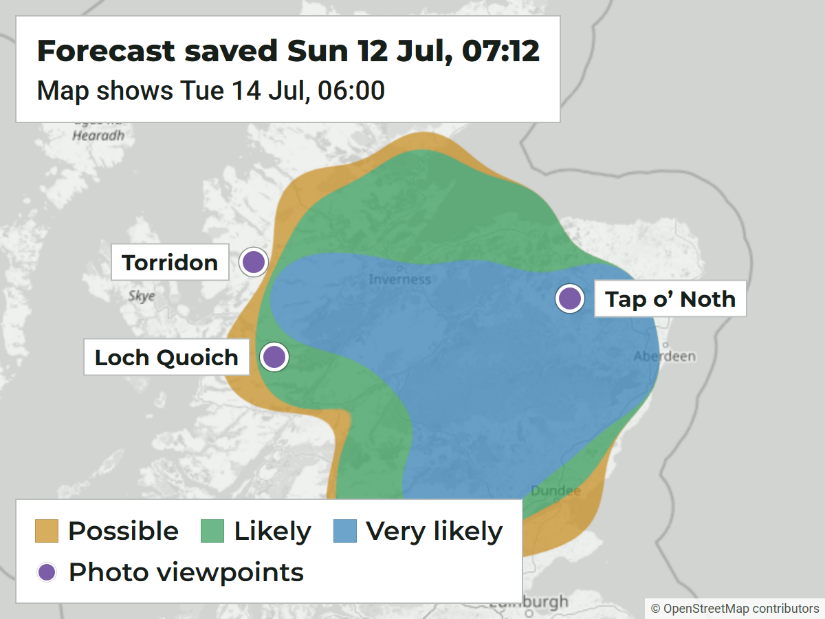
Yes. Nearly two days ahead, the forecast had a big Very likely area across the Highlands for dawn on 14 July, and three walkers found cloud below them that morning. Tap o’ Noth sat well inside it; Torridon and Loch Quoich were right on its western edge.
Three people, three corners of the Highlands, all out early on the same Tuesday: Torridon in the north west, Loch Quoich in the west and Tap o’ Noth over in Aberdeenshire, about 150 km apart. These used to be three separate checks, but it was one weather event, so it makes more sense as one story.
- Tap o’ Noth
- Very likely
- Loch Quoich
- Likely
- Torridon
- Just outside
- Forecast area
- The Highlands
- One large area from the west coast to Aberdeenshire
- First forecast
- 12 Jul, 07:12 BST
- First useful saved forecast, the map above
- Time of event
- 14 Jul, around sunrise
- Torridon photo at 05:57 BST; other times approximate
- Amount of notice
- About 43 to 46 hours
- Tap o’ Noth and Torridon; Loch Quoich was on the edge throughout
What we forecast
The first useful forecast, saved on the Sunday morning, already showed a Very likely area for Tuesday dawn. Confidence was low that far out, but by 23:09 on Monday night it was high, and the area was still there in the last update before sunrise.
These maps are redrawn from forecasts we saved before the morning, using the forecast areas the site shows today. So they show what our method makes of the saved data, not necessarily the exact map someone saw in July.
Tap o’ Noth, Aberdeenshire
This one was right in the middle of it. The Walkhighlands report describes fog near Huntly, then coming out of it on the western shoulder and watching it flow round the neighbouring hills at sunrise.
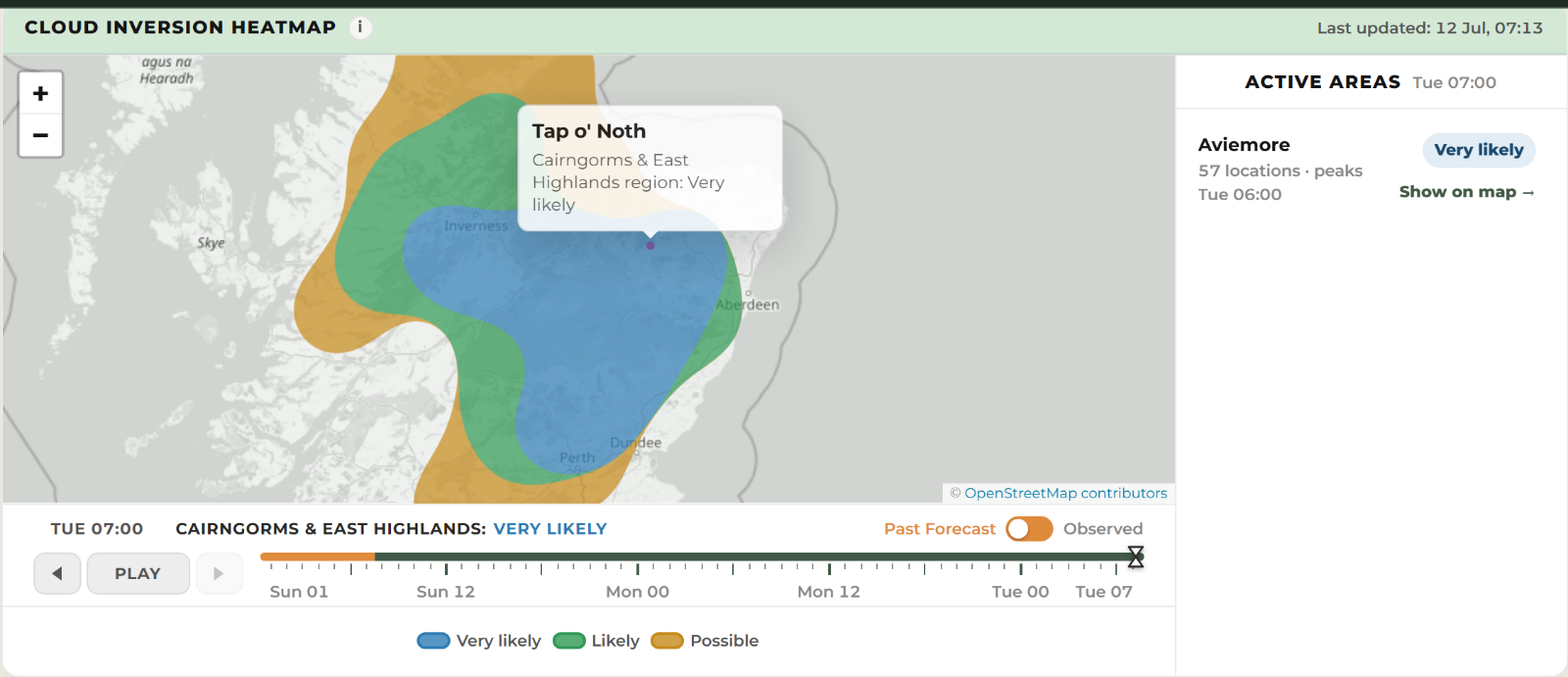
The final update gave Likely at 05:00, Very likely at 06:00 and Likely at 07:00. It put the bottom of the inversion near 323 m, well below the 563 m top, though that’s a model estimate, not a measured cloud height. Our nearest forecast point was at Oyne, about 16 km away, so this checks out for the area rather than the summit itself.
The original Tap o’ Noth sunrise report and photographs on Walkhighlands.
Final update for the morning
- 05:00
- Likely
- 06:00
- Very likely
- 07:00
- Likely
Very likelyMap for 07:00
Beinn Liath Mhòr, Torridon
The photo here is timed at 05:57, above Achnashellach. It’s a lighter one: low cloud and mist pooled in the glens below the bigger hills rather than a full cloud sea.
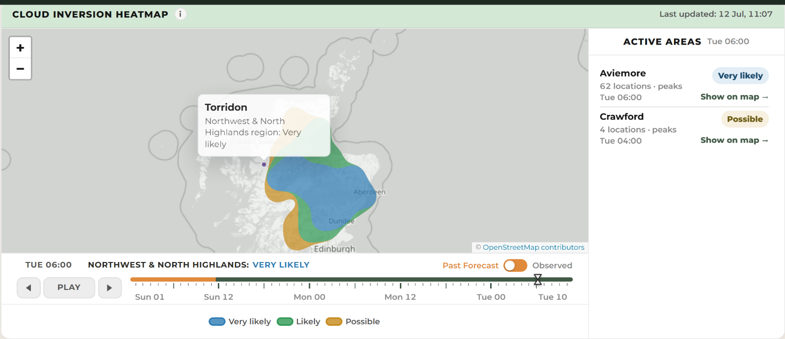
Torridon was on the edge, and our nearest forecast point stayed weaker than the area around it all the way through. I’d rather show that than give every hill the strongest rating on the map.
The original Beinn Liath Mhòr dawn report and photographs on Walkhighlands.
Just outsideLikely area 10 km east, map for 06:00
Loch Quoich
Jo Turnill’s photos show a broad cloud sea below Gleouraich and Spidean Mialach around dawn, roughly 04:30 to 06:00 going by the report rather than camera times.
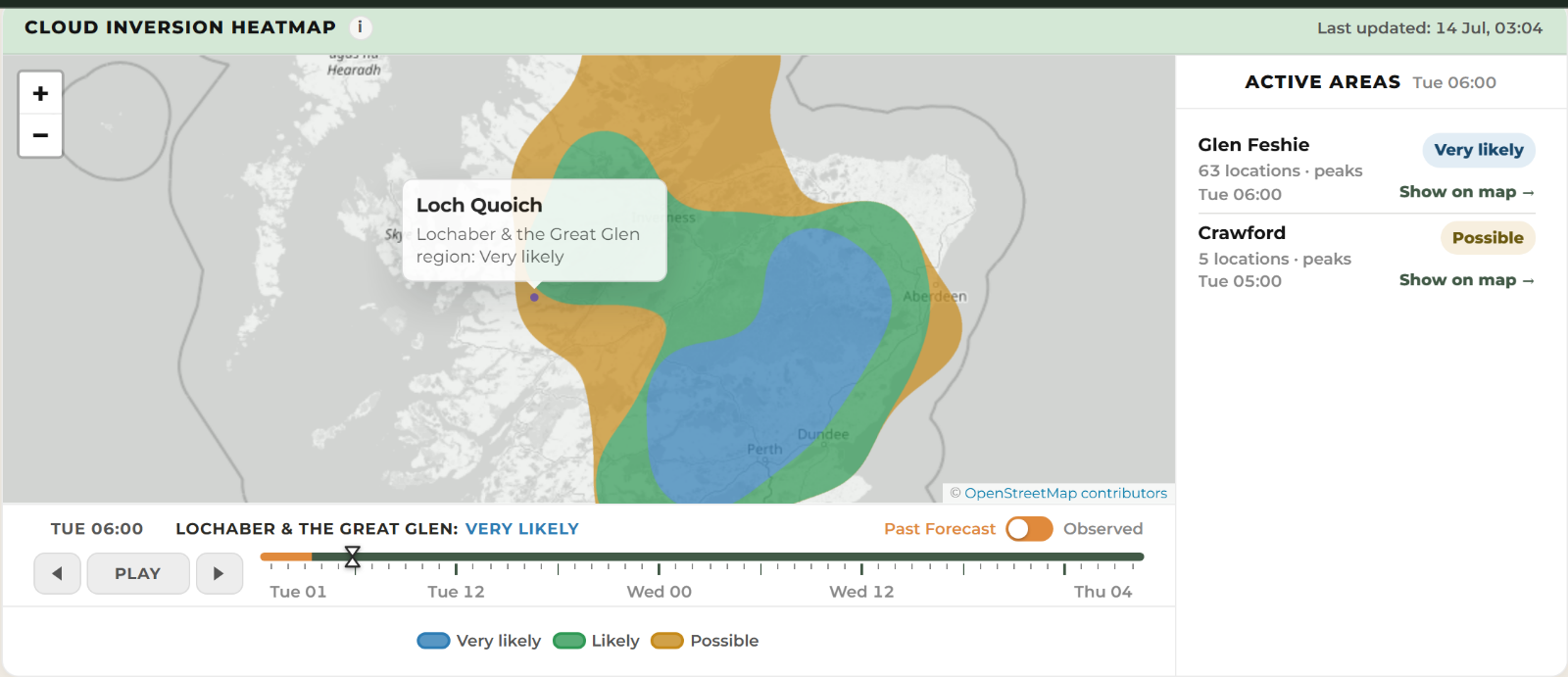
Loch Quoich sat right on the edge all along. It was just inside the Likely area on that first map, then spent most later updates in the gold Possible fringe, dipping back into Likely a few times, including the evening before. On the last update before dawn the green edge was only a few km away, inside the 15 km our alerts cover, but I wouldn’t call it a bullseye.
Jo Turnill’s original Loch Quoich photos and report. The photos remain at their original source.
LikelyMap for 06:00
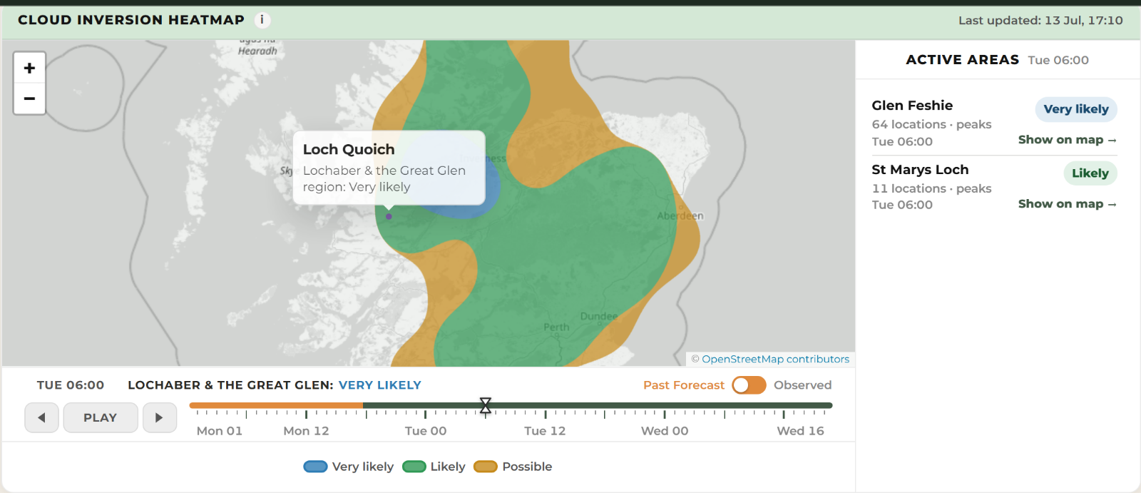
PossibleLikely edge a few km away