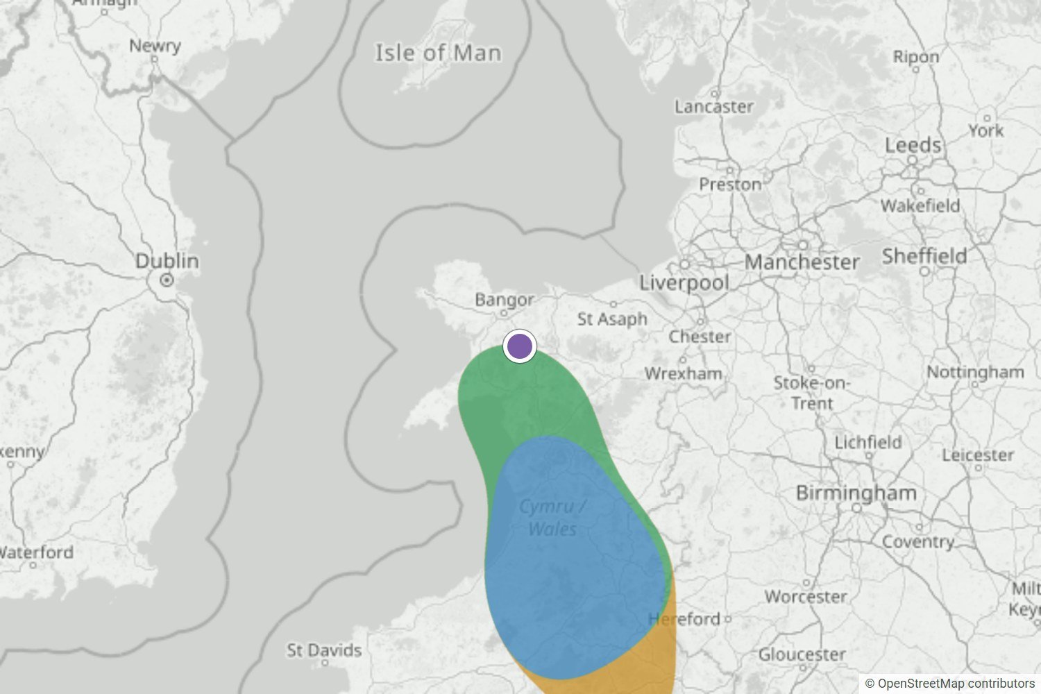
Glyder Fawr to the Bannau, Wales
Glyder Fawr was on the edge of a Likely area the night before, and Very likely by morning. The webcam was stuck in cloud, but Morgan and Neil were up above it.
Read the forecast checkBuilt for walkers & dawn photographers
No account needed.
 Free cloud inversion alerts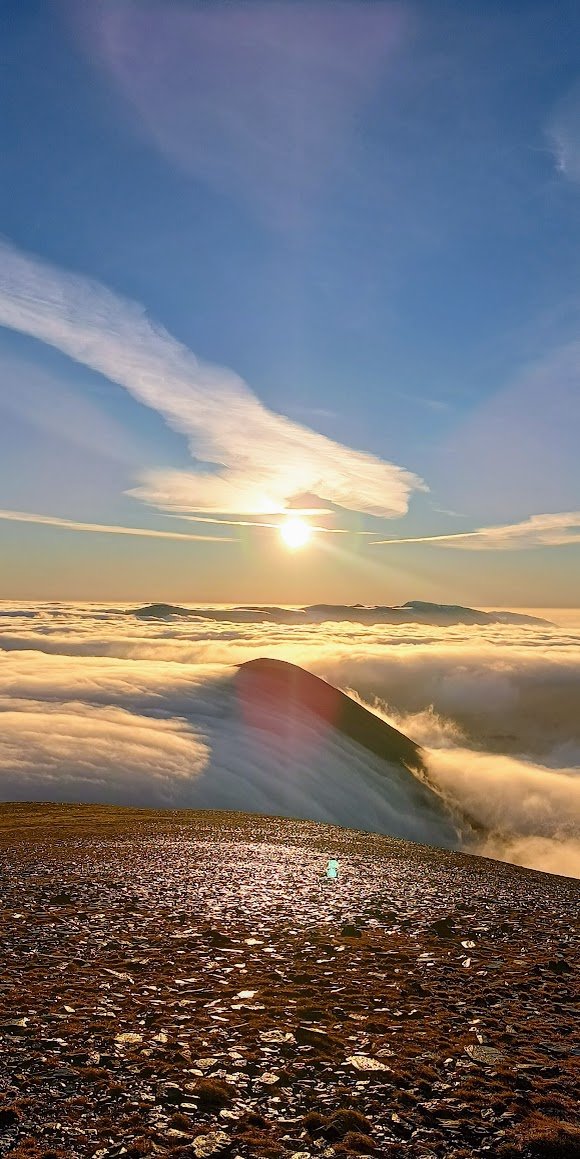
Our most recent inversions
Here’s how WeatherDuck performed across the three most recent cloud inversions in our published record. Each forecast was saved before the event, then compared with dated, independent evidence of what happened.
Glyder Fawr was on the edge of a Likely area the night before, and Very likely by morning. The webcam was stuck in cloud, but Morgan and Neil were up above it.
Read the forecast check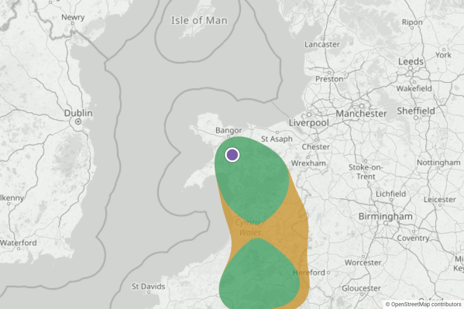
By the night before, Yr Wyddfa was Very likely. The summit webcam and a first-hand report both show it above a cloud sea across Eryri.
Read the forecast check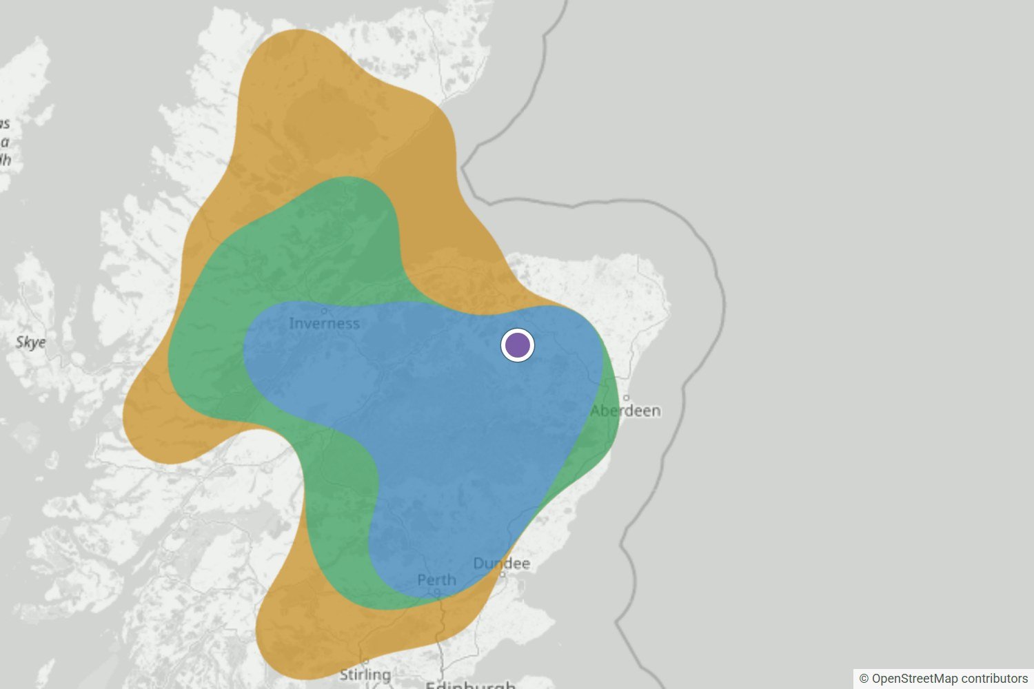
The Very likely area over the Highlands held right up to the final update. Walkers at Tap o’ Noth, Torridon and Loch Quoich found cloud below them at dawn.
Read the forecast checkWe’ll publish successful forecasts, false alarms, misses and uncertain outcomes as the record grows.
Browse all forecast checksWhat your free alert contains
When the forecast looks promising near your chosen mountain area, WeatherDuck emails you up to 24 hours ahead, giving you time to check conditions and plan your trip.
 WEATHERDUCK ALERT
Very likely cloud inversion
Conditions are lining up for a cloud inversion. Check the latest forecast before you set off.
Example email · values are illustrativeForecast without an account
Search any UK location to see the latest forecast and viewing window.
No account needed.
Latest inversion outlook
A quick UK-wide view of monitored mountain areas. Search above for the timing and atmospheric evidence at a specific place.

Unlikely
Cloud inversions look unlikely across the monitored UK mountain areas in this forecast period.
Updated Covers to
Latest forecast loaded
 Small, local or short-lived pockets of valley fog can still form.
See timing, cloud heights and atmospheric evidence for your nearest valleys and summits.
See full forecast
Compare the forecast cloud-top height with your summit elevation. Cloud heights are estimates above sea level, and the actual cloud layer may sit higher or lower.

These bands describe the strength of WeatherDuck’s cloud inversion forecast signal. Very likely is the stronger signal; neither rating is a percentage chance or a guarantee of a clear summit.
Cloud inversion guide
A cloud inversion happens when cold, moist air becomes trapped beneath warmer air. When moisture in the cold layer condenses into fog or low cloud, valleys can fill with cloud while higher hills rise into clearer air. Seen from a summit, this becomes the familiar sea of cloud.
Read the full guide: what is a cloud inversion?
After sunset, the ground loses heat and cools the air directly above it. Cold air is denser than warm air, so it tends to flow down slopes and gather in valleys, glens, hollows and sheltered basins. This movement is known as cold air drainage.
If the wider weather pattern is calm, the pooled air can remain in place for much of the night. Warmer air above limits mixing and keeps the cold pool close to the landscape. A valley can therefore become much colder than a nearby ridge even though the two places are only a short distance apart.
Cooling air eventually reaches a temperature at which some of its water vapour begins to condense. This temperature is called the dew point. Tiny water droplets then form in the air, creating fog at ground level or a shallow sheet of low cloud across the valley.
A temperature inversion can exist without any visible cloud. If the trapped air is too dry, the warm lid may be present but the valley will stay clear. The classic sea of cloud needs both the layered temperature structure and enough moisture in the lower air.
The warm lid traps moisture in a shallow layer near the valley floor. The valley may then be misty and dull while the air above the cloud is warmer, drier and clearer. A hill that rises through the cloud top can reach sunshine even when communities below remain under fog.
This separation is what turns ordinary valley fog into a useful summit view. If moisture and cloud continue through the higher atmosphere, the result is more likely to be widespread hill cloud or overcast rather than a clean sea of cloud.
Fog and cloud inversions are close relatives, and from inside the murk they can feel identical. The difference is what is happening above your head, and it decides whether a dawn start ends in sunshine or in damp grey.
The tell is the cloud top. A true inversion has a defined ceiling, with warmer, drier, clearer air above it and the summits standing proud of it.
This is the raw ingredient of a cloud sea, and the fog you want to see filling the valleys below you.
It often burns off during the morning as the sun warms the ground.
The summits are inside it, not above it. This is the classic disappointment: the valley webcam looks promising, but the tops never break clear.
It can photograph exactly like an inversion from a distance, but there is often no warm lid above it, so the top is ragged and a summit that looks clear one minute is swallowed the next.
Beautiful above the cloud top, and a real hazard on paths inside it.
If moisture continues up through the atmosphere, there is no ceiling to break through, and what looks like a sea of cloud from the valley is really the bottom of a much deeper layer.
This is exactly what the forecast checks for you. It looks for temperature rising with height, moisture trapped beneath drier air, and a cloud top sitting below the summits. When the profile shows cloud continuing upwards instead, the score stays low, because that morning is hill fog, not a cloud sea.
Read the signs
There isn’t one magic forecast symbol. The most convincing setup is a group of clues that agree: cold, moist air pooled on lower ground, a warmer layer above it, light winds and a cloud top below your chosen viewpoint. Work through these six checks, then look again at the newest forecast before you travel.
Compare the forecast’s cloud-top estimate with the height of your ridge or summit, using metres above sea level for both. Nearby slopes can still sit in different cloud.
Thick cloud can slow the cooling, and stronger wind can stir the layers together.
Damp soil, recent rain, rivers and lakes can add moisture. Dry valley air can produce an inversion without any visible cloud.
That warmer layer is the inversion, the lid that can limit mixing below. It is an important clue, but it cannot promise a sea of cloud on its own.
Compare the estimated cloud top with your viewpoint and look for drier air above. Deep cloud through summit level is a warning that you may simply be inside it.
Check the latest cloud inversion and mountain forecasts before setting off, as conditions can change quickly.
Ready to check the setup?
Search any UK location to see the next 24 hours, the strongest viewing window and the atmospheric evidence behind the WeatherDuck band.
Before you set the alarm
Check the current UK outlook at the top of this page. It always shows the latest national cloud inversion signal for the next 24 hours, the monitored mountain regions worth watching and when the dataset was last updated. For a specific summit or valley, search the location to see its timing and atmospheric evidence.
No. The bands describe the overall strength of the WeatherDuck forecast signal; they are not percentage chances or promises that a particular summit will be clear. Read the band alongside the viewing window, cloud-top estimate, wind and wider mountain forecast.
Valley fog can provide the cloud within an inversion, but fog alone does not guarantee a sea of cloud. The layer needs to remain below the viewpoint with clearer air above it. A temperature inversion can also form without visible cloud when the lower air is too dry.
The viewpoint needs to be above the actual cloud top, not merely above the valley floor. Any modelled cloud height is an estimate above sea level, and local cloud can sit higher or lower than forecast. Choose a safe viewpoint and never treat a modelled height as a route recommendation.
You need to be above the cloud top, but that does not always mean a long climb. From inside the valley an inversion simply looks like fog or a grey sky. Some high roads, passes and smaller hills rise above shallow layers, which is why comparing the cloud-top estimate with your own height matters.
Around dawn. The cold pool and its cloud are usually deepest at the end of a long night, and first light is also when the view is at its best for photography. Daytime heating then stirs the layers, so many inversions fade during the morning.
Autumn and winter are the classic seasons. Long, clear and calm nights give valleys time to cool, and high pressure can hold the cold, foggy layer in place well into the day. Inversions can still form in spring and summer, but they are usually shallower and break up soon after sunrise.
Anything from under an hour to several days. Most morning inversions fade as the sun warms the ground and wind mixes the layers. In deep winter valleys under settled high pressure, the cloud can survive all day, a pattern sometimes called anticyclonic gloom.
Small changes in wind, moisture, temperature and cloud depth can decide whether a valley pool forms or survives. The outlook changes as newer forecast information becomes available.
You can search any UK location. The national view summarises monitored mountain areas, while the full forecast shows the available outlook and atmospheric evidence for the searched place.
WeatherDuck captures fresh forecast data throughout the day. The UK outlook shows when its current dataset was updated and when the forecast window ends, so check those times and the latest mountain forecast before travelling.
WeatherDuck works as a cloud inversion predictor in any browser, with nothing to install. Search a location for the latest outlook, add the site to your phone home screen for one tap access, and set a free email alert so a Likely forecast finds you first.
Popular inversion forecasts
Start with a wider region, or go straight to a popular mountain. Every page has its own fixed 24-hour map and terrain-specific guide to reading the inversion setup.
Use these wider fixed maps to compare valleys and basins before choosing a particular viewpoint.
Derbyshire and the South Pennines
Follow the broader signal across Edale, Castleton, the Hope Valley and the surrounding high moorland.
Open the Peak District outlookCumbria
See whether Keswick, Borrowdale and Great Langdale support the same wider regional cloud-sea setup.
Open the Lake District outlookNorth Wales
Compare Capel Curig, Nant Gwynant and the Ogwen Valley across a wider view of Eryri’s mountain basins.
Open the Eryri outlookSouth Wales
Compare the cloud inversion outlook around Brecon, Pen y Fan and the surrounding valleys.
Open the Bannau Brycheiniog outlookNationwide mountain view
Scan the wider Highland pattern, with the single headline clearly labelled as the central Highlands regional signal.
Open the Scotland outlookThese closer fixed maps use a tighter zoom and explain the cloud-height clues around each mountain.
Lake District, Howgills & Eden Valley
Scafell Pike is the highest ground in England, ringed by the deep valleys of Wasdale, Eskdale and Borrowdale. Its height is an advantage: a cloud sea that drowns lower fells can still leave the summit in clear air above an unbroken white layer.
Open the Scafell Pike forecastBannau Brycheiniog / Brecon Beacons
Pen y Fan stands above the Usk valley, where cold air drains off the Beacons and pools overnight around Brecon and Talybont-on-Usk. The classic cloud sea forms when that valley layer stays below the summit ridge with drier, clearer air above.
Open the Pen y Fan forecastEryri / Snowdonia & North Wales
Cadair Idris rises between the Mawddach estuary at Dolgellau and the deep trench of Tal-y-llyn. Sea air and valley fog can fill both sides overnight, leaving Penygadair and the Tyrrau Mawr ridge standing above a two sided sea of cloud.
Open the Cadair Idris forecastPeak District
Track the signal around Edale, Hope Valley and Castleton, with the map centred on the ridge itself.
Open the Mam Tor forecastLake District
Compare the dawn setup around Glenridding, Thirlmere and the valleys on both sides of the summit.
Open the Helvellyn forecastEryri / Snowdonia
Compare the regional setup around Rhyd Ddu, Nant Gwynant and Llanberis beneath the summit.
Open the Yr Wyddfa forecastLochaber
Watch Glen Nevis, Fort William and Spean Bridge beneath the summit and its changeable Atlantic cloud.
Open the Ben Nevis forecastLoch Lomond and the Trossachs
Compare low cloud around the loch and neighbouring glens with the summit and the air above it.
Open the Ben Lomond forecastIsle of Skye
Use a close Trotternish map and distinguish the Storr summit from the lower Old Man pinnacle.
Open The Storr forecastNo card needed
Create a free account, choose your mountain area and let WeatherDuck keep watch.
Create my free alert