Glyder Fawr to the Bannau, Wales
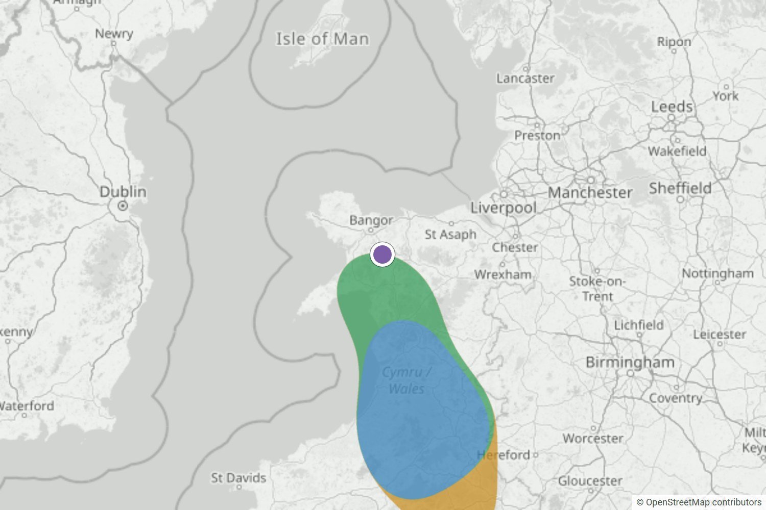
Glyder Fawr was on the edge of a Likely area the night before, and Very likely by morning. The webcam was stuck in cloud, but Morgan and Neil were up above it.
Read the forecast checkPeak District & South Pennines
Nothing forming around Mam Tor right now. We’ll email you when that changes.
Captured 21 Oct, 23:10 BST · model rating, not a literal probabilityFree Mam Tor alert. We email you when a cloud inversion looks likely. No card needed.
Checked against what happened
We save each forecast before dawn, then compare it with dated photos of what happened. The nearest check to Mam Tor so far is Glyder Fawr to the Bannau, about 150 km west.
Glyder Fawr was on the edge of a Likely area the night before, and Very likely by morning. The webcam was stuck in cloud, but Morgan and Neil were up above it.
Read the forecast check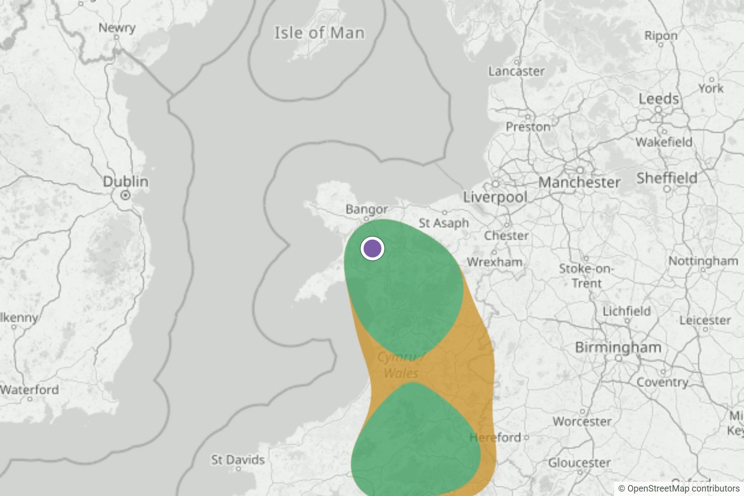
By the night before, Yr Wyddfa was Very likely. The summit webcam and a first-hand report both show it above a cloud sea across Eryri.
Read the forecast check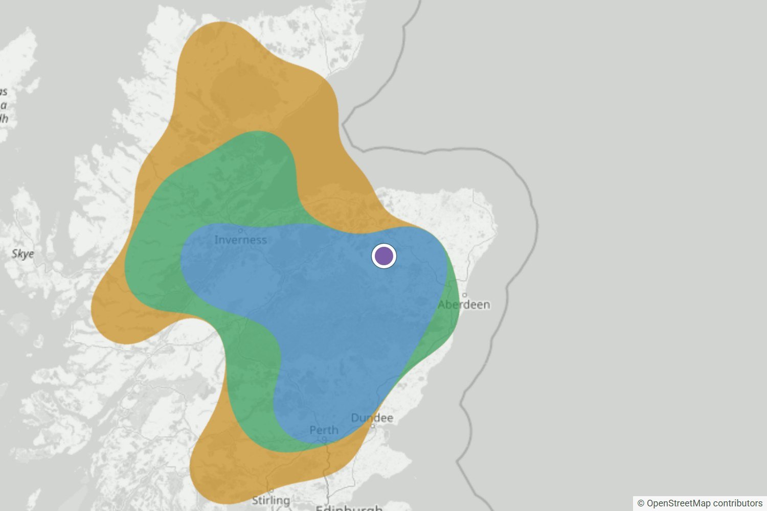
The Very likely area over the Highlands held right up to the final update. Walkers at Tap o’ Noth, Torridon and Loch Quoich found cloud below them at dawn.
Read the forecast checkWe’ll publish misses and uncertain calls too, as the record grows.
Browse all forecast checksWhat your free alert looks like
When a cloud inversion looks likely near Mam Tor, WeatherDuck emails you up to 24 hours ahead, so you’ve time to check the route and set an alarm.
 WEATHERDUCK ALERT
Likely cloud inversion
Conditions are lining up for a cloud inversion. Check the latest forecast before you set off.
Example email · values are illustrativeLocal inversion guide
The best chance comes when colder, moist air settles on low ground beneath warmer, drier air, winds stay light and the cloud top remains below your viewpoint.
Mam Tor rises between the Edale and Hope valleys. A useful cloud sea needs low cloud pooled below the ridge while the air above the summit stays drier and clearer.
Fog in Castleton or Edale is encouraging, but it is not enough on its own. A deeper cloud layer can cover the ridge, while shallow valley fog can leave Mam Tor clear above it.
Before you travel: the map shows the wider pattern across Peak District & South Pennines, not a promise for one summit. Check the latest wind, visibility and mountain forecast for your exact route.
See the forecast data and limitationsLook for warmer air sitting above colder valley air. That temperature lid is the structure that can trap fog below Mam Tor.
Moist air needs to collect in the surrounding valleys. The local map shows whether nearby forecast points agree, not just one isolated fog patch.
The most photogenic setup keeps the cloud top below the ridge with noticeably drier air above. If the layer is deeper, Mam Tor may sit inside cloud.
Light low-level wind helps the pool hold together. The best chance is usually around dawn, before daytime heating starts to break the layer up.
Plan beyond tomorrow
The public map stays focused on the next 24 hours. Premium extends the detailed inversion map, atmospheric profile and forecast window to two days.
Explore more forecasts around Peak District.
Browse other Peak District locationsQuick answers
No. Valley fog is one useful clue, but Mam Tor also needs the cloud top to stay below the ridge and the air above it to remain clear enough for a view.
No. The likelihood band is a regional model signal for the Peak District and South Pennines, supported by nearby captured forecast points. Local cloud can still differ.
No. The inversion outlook describes cloud structure, not path, wind, ice, visibility or access safety. Check the full mountain forecast and local guidance before setting out.
Be ready for the next window
We’ll let you know when conditions look promising, so you can check the latest map and mountain forecast before deciding.
Create my free alert