Yr Wyddfa, Wales
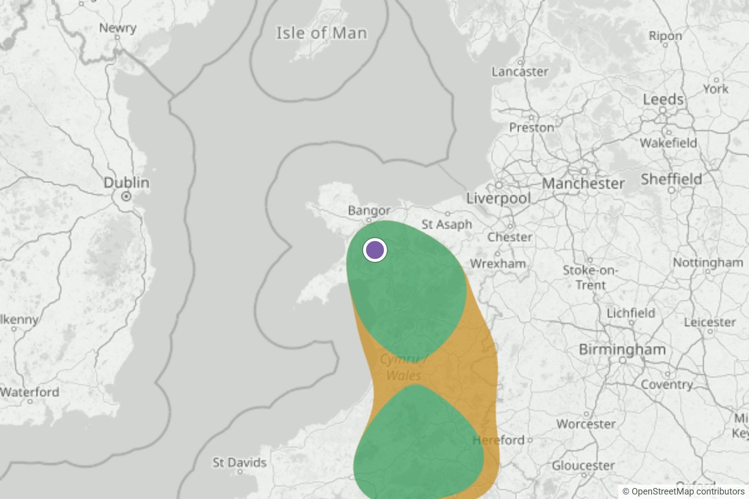
By the night before, Yr Wyddfa was Very likely. The summit webcam and a first-hand report both show it above a cloud sea across Eryri.
Read the forecast checkEryri / Snowdonia & North Wales
Nothing forming around Yr Wyddfa right now. We’ll email you when that changes.
Captured 20 Oct, 21:07 BST · model rating, not a literal probabilityFree Yr Wyddfa alert. We email you when a cloud inversion looks likely. No card needed.
Checked against what happened
We save each forecast before dawn, then compare it with dated photos of what happened. Here’s how our Yr Wyddfa forecast did, alongside our latest checks.
By the night before, Yr Wyddfa was Very likely. The summit webcam and a first-hand report both show it above a cloud sea across Eryri.
Read the forecast check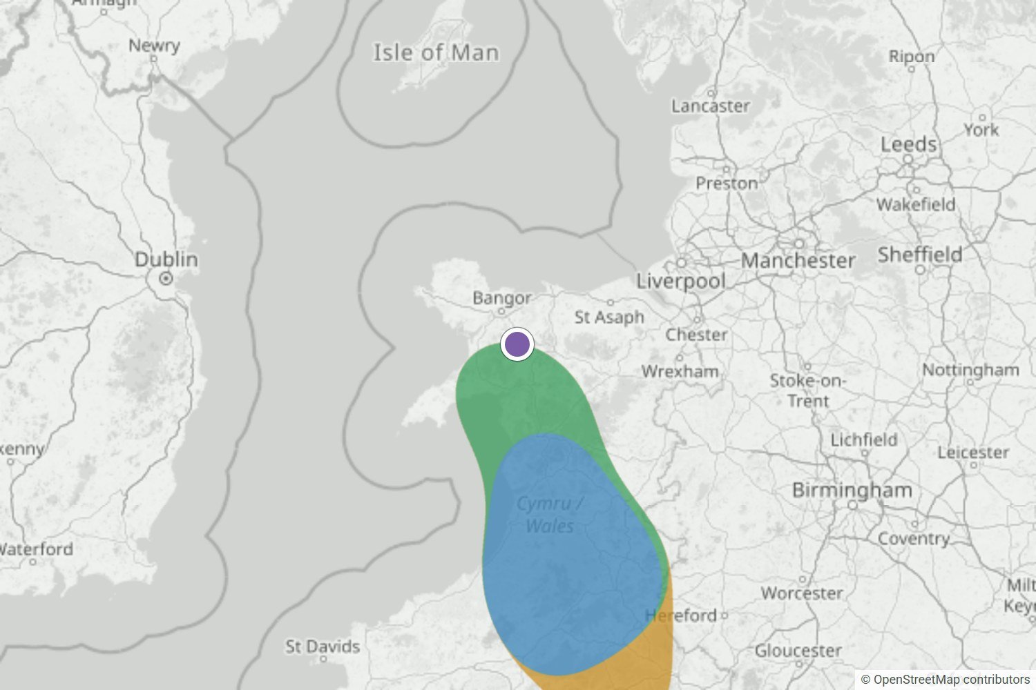
Glyder Fawr was on the edge of a Likely area the night before, and Very likely by morning. The webcam was stuck in cloud, but Morgan and Neil were up above it.
Read the forecast check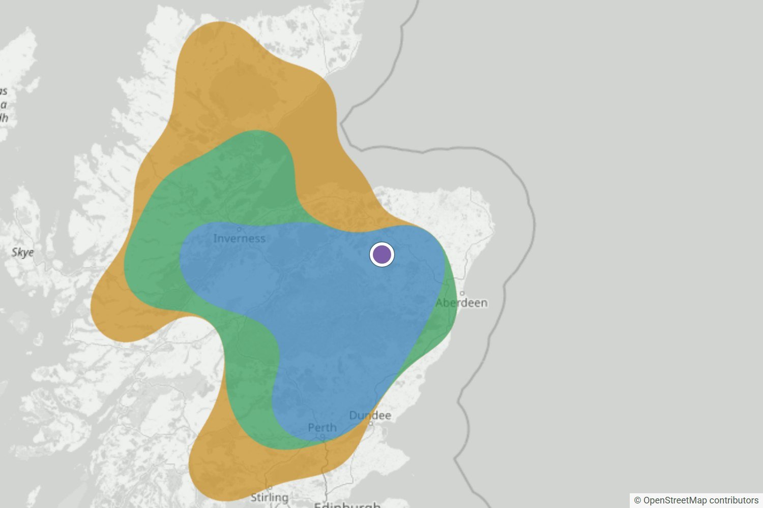
The Very likely area over the Highlands held right up to the final update. Walkers at Tap o’ Noth, Torridon and Loch Quoich found cloud below them at dawn.
Read the forecast checkWe’ll publish misses and uncertain calls too, as the record grows.
Browse all forecast checksWhat your free alert looks like
When a cloud inversion looks likely near Yr Wyddfa, WeatherDuck emails you up to 24 hours ahead, so you’ve time to check the route and set an alarm.
 WEATHERDUCK ALERT
Likely cloud inversion
Conditions are lining up for a cloud inversion. Check the latest forecast before you set off.
Example email · values are illustrativeLocal inversion guide
The best chance comes when colder, moist air settles on low ground beneath warmer, drier air, winds stay light and the cloud top remains below your viewpoint.
Yr Wyddfa rises above several deep approaches, including Rhyd Ddu, Nant Gwynant and Llanberis. Low cloud can fill one valley while another side of the mountain stays open.
A regional Eryri signal does not guarantee a clear summit. Look for a cloud top comfortably below the mountain, a strong moisture contrast at the top of the layer and dry air above it.
Before you travel: the map shows the wider pattern across Eryri / Snowdonia & North Wales, not a promise for one summit. Check the latest wind, visibility and mountain forecast for your exact route.
See the forecast data and limitationsThe temperature profile should show warmer air above colder, moist air lower down. A clear lid helps trap the valley cloud beneath the higher slopes.
Rhyd Ddu, Nant Gwynant and Llanberis can behave differently. Agreement across nearby forecast points is stronger evidence than fog in only one approach.
A useful cloud sea needs its top well below Yr Wyddfa with drier air above. Thick hill cloud can hide the summit even when lower valleys are foggy.
Light wind helps a cloud pool survive. The strongest window is often near dawn, but exposed summit conditions can still be very different from the valleys.
Plan beyond tomorrow
The public map stays focused on the next 24 hours. Premium extends the detailed inversion map, atmospheric profile and forecast window to two days.
Premium is available at weatherduck.co.uk.
Open the full Yr Wyddfa (Snowdon) forecastExplore more forecasts around Eryri / Snowdonia & North Wales.
Browse other Eryri / Snowdonia & North Wales locationsQuick answers
Yes. Yr Wyddfa is the Welsh name prioritised by Eryri National Park, and Snowdon is included so people using either name reach the same canonical forecast page.
Yes. Eryri's terrain is complex, so valley cloud can vary around Rhyd Ddu, Nant Gwynant and Llanberis. The map helps show whether the wider regional signal agrees.
No. It is a cloud-inversion signal, not a route or safety recommendation. Yr Wyddfa is a serious mountain; check the full weather forecast, route conditions and official safety advice.
Be ready for the next window
We’ll let you know when conditions look promising, so you can check the latest map and mountain forecast before deciding.
Create my free alert