
| Time |
| Condition |
| Precip mm |
| Precip % |
| Temp |
| Temp °C |
| Feels °C |
| Wind |
| Direction |
| Wind mph |
| Gust mph |
| Detail |
| Humidity % |
| Pressure |
| Vis km |
| UV Index |
| CAPE J/kg |
| Score |
| Thu 22 Oct | Fri 23 Oct | Sat 24 Oct | Sun 25 Oct | Mon 26 Oct | Tue 27 Oct | |||||||||||||||||||||||||||||||||||||||||||||||||||||||||||||||||||||||||||||||||||||||||||||||||||||||||||||||||||||||||||||||||||||||||||
| 00:00 | 01:00 | 02:00 | 03:00 | 04:00 | 05:00 | 06:00 | 07:00 | 08:00 | 09:00 | 10:00 | 11:00 | 12:00 | 13:00 | 14:00 | 15:00 | 16:00 | 17:00 | 18:00 | 19:00 | 20:00 | 21:00 | 22:00 | 23:00 | 00:00 | 01:00 | 02:00 | 03:00 | 04:00 | 05:00 | 06:00 | 07:00 | 08:00 | 09:00 | 10:00 | 11:00 | 12:00 | 13:00 | 14:00 | 15:00 | 16:00 | 17:00 | 18:00 | 19:00 | 20:00 | 21:00 | 22:00 | 23:00 | 00:00 | 01:00 | 02:00 | 03:00 | 04:00 | 05:00 | 06:00 | 07:00 | 08:00 | 09:00 | 10:00 | 11:00 | 12:00 | 13:00 | 14:00 | 15:00 | 16:00 | 17:00 | 18:00 | 19:00 | 20:00 | 21:00 | 22:00 | 23:00 | 00:00 | 01:00 | 01:00 | 02:00 | 03:00 | 04:00 | 05:00 | 06:00 | 07:00 | 08:00 | 09:00 | 10:00 | 11:00 | 12:00 | 13:00 | 14:00 | 15:00 | 16:00 | 17:00 | 18:00 | 19:00 | 20:00 | 21:00 | 22:00 | 23:00 | 00:00 | 01:00 | 02:00 | 03:00 | 04:00 | 05:00 | 06:00 | 07:00 | 08:00 | 09:00 | 10:00 | 11:00 | 12:00 | 13:00 | 14:00 | 15:00 | 16:00 | 17:00 | 18:00 | 19:00 | 20:00 | 21:00 | 22:00 | 23:00 | 00:00 | 01:00 | 02:00 | 03:00 | 04:00 | 05:00 | 06:00 | 07:00 | 08:00 | 09:00 | 10:00 | 11:00 | 12:00 | 13:00 | 14:00 | 15:00 | 16:00 | 17:00 | 18:00 | 19:00 | 20:00 | 21:00 | 22:00 | 23:00 |
|
|
|

|
|
|
|
|
|

|

|

|
|
|

|
|
|
|
|
|

|

|
|
|
|
|
|
|
|
|
|
|
|

|

|
|
|
|
|
|

|

|
|
|
|
|

|
|
|

|
|
|
|
|
|
|
|
|
|
|
|

|
|

|
|
|
|
|
|
|
|
|
|
|
|
|
|
|
|
|
|
|
|
|
|
|
|
|
|
|
|
|
|
|
|
|
|
|
|
|
|
|
|
|
|
|
|
|
|
|
|
|
|
|
|
|
|

|
|
|

|
|
|
|
|
|
|
|
|
|
|
|
|
|
|
|
|
|
|
|
|
|
|
|
|
|
| 2.3 | 0.9 | - | - | - | - | - | - | - | - | - | - | - | - | - | - | - | - | - | - | 0.1 | - | - | - | - | - | - | - | - | - | - | 0.3 | 0.6 | 0.5 | 0.5 | 0.4 | 0.5 | 0.3 | 0.2 | - | - | - | - | - | - | - | - | - | - | - | - | - | - | - | - | - | - | - | - | - | 3.2 | 3.2 | 4.5 | 4.5 | - | - | - | - | - | - | - | - | - | - | - | - | - | - | - | - | - | - | - | - | 0.3 | 0.3 | 0.1 | - | - | - | - | - | - | - | - | - | - | - | - | - | - | - | - | - | - | - | - | - | - | - | - | - | - | - | - | - | 0.3 | 0.3 | 0.3 | 0.6 | 0.6 | - | - | - | - | - | - | - | - | - | - | - | - | - | - | - | - | - | - | - | - | - | - | - | - |
| 100% | 100% | 70% | 30% | 35% | 20% | 15% | 30% | 15% | 15% | 35% | 35% | 30% | 15% | 10% | 15% | 15% | 15% | 25% | 25% | 80% | 20% | 20% | 30% | 10% | 15% | 15% | 10% | 10% | 20% | 50% | 100% | 100% | 100% | 100% | 100% | 100% | 100% | 100% | 100% | 100% | 55% | 30% | 30% | 20% | 0% | 0% | 0% | 10% | 25% | 25% | 25% | 25% | 25% | 25% | 30% | 25% | 30% | 90% | 100% | 100% | 100% | 100% | 100% | 100% | 100% | 100% | 100% | 100% | 100% | 100% | 100% | 100% | 100% | 100% | 100% | 100% | 100% | 100% | 100% | 90% | 90% | 90% | 90% | 65% | 55% | 60% | 75% | 75% | 90% | 95% | 95% | 100% | 100% | 100% | 100% | 100% | 100% | 95% | 95% | 95% | 65% | 35% | 35% | 25% | 20% | 30% | 70% | 75% | 80% | 100% | 100% | 100% | 100% | 100% | 100% | 80% | 75% | 75% | 75% | 75% | 100% | 95% | 95% | 100% | 100% | 100% | 100% | 100% | 100% | 100% | 100% | 100% | 100% | 75% | 75% | 75% | 75% | 75% | 70% | 35% | 10% | 10% | 10% | 0% |
| -1° | -2° | -2° | -2° | -2° | -2° | -2° | -2° | -2° | -2° | -2° | -2° | -1° | -0° | 0° | 0° | 0° | 0° | -1° | -1° | -1° | -1° | -1° | -1° | -1° | -1° | -1° | -0° | -1° | -1° | -1° | -2° | -2° | -2° | -2° | -3° | -2° | -3° | -3° | -3° | -3° | -3° | -3° | -3° | -3° | -3° | -3° | -4° | -5° | -6° | -7° | -7° | -7° | -6° | -5° | -5° | -4° | -3° | -2° | -0° | 1° | 1° | 1° | 0° | -0° | -1° | -1° | -1° | -1° | -1° | -0° | -0° | -0° | -0° | -1° | -1° | -1° | -1° | -1° | -0° | -1° | -1° | -1° | -1° | 0° | 1° | 0° | -0° | -1° | -1° | -2° | -2° | -2° | -2° | -2° | -2° | -1° | -1° | -1° | -1° | -1° | -1° | -1° | -2° | -1° | -1° | -1° | -1° | -0° | -0° | -0° | -1° | -1° | -1° | -1° | -0° | 1° | 3° | 3° | 2° | 0° | -1° | -2° | -2° | -2° | -2° | -2° | -3° | -3° | -2° | -2° | -2° | -1° | -1° | -1° | -1° | -1° | -1° | -1° | -1° | -1° | -1° | -1° | -1° | -1° |
| -7° | -7° | -7° | -7° | -7° | -7° | -8° | -8° | -8° | -7° | -7° | -7° | -7° | -6° | -6° | -5° | -5° | -5° | -5° | -5° | -5° | -5° | -5° | -5° | -6° | -6° | -6° | -6° | -6° | -7° | -7° | -6° | -6° | -6° | -5° | -6° | -7° | -9° | -9° | -8° | -9° | -8° | -8° | -8° | -8° | -8° | -8° | -8° | -9° | -9° | -10° | -10° | -10° | -10° | -9° | -9° | -8° | -7° | -6° | -6° | -6° | -6° | -6° | -6° | -7° | -8° | -8° | -9° | -9° | -8° | -8° | -8° | -8° | -8° | -8° | -9° | -9° | -9° | -9° | -9° | -10° | -10° | -10° | -9° | -9° | -8° | -8° | -8° | -9° | -9° | -9° | -9° | -8° | -8° | -8° | -8° | -7° | -7° | -7° | -7° | -7° | -7° | -7° | -6° | -6° | -5° | -4° | -4° | -4° | -5° | -4° | -4° | -4° | -4° | -3° | -3° | -4° | -4° | -5° | -6° | -7° | -8° | -8° | -7° | -7° | -7° | -7° | -7° | -7° | -7° | -6° | -6° | -6° | -6° | -6° | -6° | -6° | -6° | -6° | -6° | -6° | -6° | -6° | -6° | -6° |
| WNW | NW | NW | NW | WNW | NW | WNW | WNW | WNW | WNW | WNW | W | W | W | W | WSW | W | WSW | SW | SSW | S | SSE | SSE | SE | SE | SE | SE | SE | SE | SE | SE | SE | SE | ESE | SSW | WSW | W | W | NNW | NNW | NNW | NNW | NNW | NW | NW | NW | NW | W | WSW | S | SSE | SSE | SSE | SE | SE | SE | SE | SSE | SSE | SSE | SSE | SSE | S | SSW | SW | SW | SW | SW | SW | SW | SW | WSW | WSW | WSW | WSW | W | W | W | W | W | W | W | W | W | W | W | W | W | W | W | WSW | WSW | WSW | WSW | WSW | WSW | SW | SW | SW | SW | SW | SW | SW | SW | S | SSE | ESE | ESE | ESE | ESE | ESE | E | E | E | ESE | ESE | SE | SSE | SSW | SSW | SW | SW | WSW | WSW | WSW | WSW | WSW | WSW | SW | SW | SW | SW | SW | SW | SW | SW | WSW | WSW | WSW | WSW | WSW | WSW | WSW | WSW | WSW |
| 13 | 12 | 12 | 10 | 11 | 11 | 12 | 13 | 12 | 11 | 11 | 12 | 13 | 15 | 15 | 13 | 12 | 9 | 8 | 6 | 7 | 9 | 9 | 8 | 10 | 10 | 11 | 12 | 9 | 13 | 13 | 8 | 7 | 5 | 1 | 4 | 7 | 14 | 13 | 12 | 14 | 13 | 13 | 11 | 11 | 8 | 9 | 6 | 4 | 3 | 2 | 2 | 2 | 3 | 4 | 5 | 6 | 8 | 10 | 13 | 17 | 19 | 19 | 18 | 17 | 19 | 21 | 23 | 23 | 23 | 22 | 22 | 22 | 22 | 23 | 24 | 25 | 26 | 26 | 26 | 26 | 25 | 25 | 25 | 25 | 24 | 23 | 22 | 21 | 20 | 19 | 17 | 17 | 16 | 15 | 15 | 14 | 13 | 13 | 13 | 12 | 11 | 11 | 9 | 7 | 4 | 2 | 3 | 6 | 7 | 6 | 4 | 3 | 2 | 1 | 3 | 10 | 18 | 24 | 24 | 21 | 18 | 15 | 13 | 10 | 9 | 8 | 7 | 7 | 7 | 7 | 9 | 9 | 10 | 10 | 11 | 11 | 11 | 11 | 12 | 12 | 11 | 11 | 11 | 11 |
| 24 | 26 | 25 | 21 | 24 | 23 | 26 | 26 | 24 | 23 | 22 | 23 | 26 | 27 | 27 | 24 | 22 | 18 | 17 | 14 | 14 | 17 | 18 | 15 | 19 | 21 | 23 | 24 | 19 | 26 | 26 | 17 | 14 | 10 | 3 | 8 | 13 | 26 | 29 | 27 | 29 | 28 | 28 | 25 | 23 | 18 | 20 | 14 | 10 | 6 | 3 | 2 | 3 | 4 | 6 | 10 | 15 | 21 | 26 | 33 | 39 | 43 | 42 | 39 | 38 | 41 | 46 | 49 | 50 | 49 | 49 | 48 | 48 | 48 | 50 | 54 | 56 | 57 | 58 | 58 | 57 | 56 | 55 | 54 | 54 | 53 | 51 | 49 | 46 | 43 | 41 | 38 | 36 | 35 | 34 | 32 | 31 | 30 | 29 | 28 | 27 | 25 | 24 | 21 | 15 | 8 | 4 | 7 | 13 | 17 | 16 | 14 | 12 | 9 | 6 | 9 | 21 | 39 | 51 | 51 | 45 | 39 | 34 | 28 | 23 | 20 | 18 | 17 | 16 | 16 | 16 | 18 | 20 | 21 | 22 | 23 | 24 | 25 | 26 | 26 | 26 | 26 | 25 | 25 | 24 |
| 100 | 100 | 98 | 90 | 95 | 89 | 86 | 87 | 89 | 91 | 95 | 94 | 94 | 82 | 76 | 84 | 84 | 84 | 91 | 90 | 91 | 90 | 91 | 92 | 88 | 91 | 88 | 78 | 80 | 82 | 81 | 88 | 94 | 93 | 95 | 97 | 100 | 100 | 100 | 97 | 98 | 93 | 95 | 91 | 87 | 84 | 77 | 82 | 87 | 93 | 99 | 99 | 98 | 96 | 93 | 91 | 89 | 88 | 88 | 89 | 91 | 92 | 89 | 85 | 83 | 85 | 89 | 92 | 93 | 93 | 93 | 92 | 91 | 89 | 88 | 87 | 85 | 82 | 77 | 74 | 73 | 72 | 70 | 64 | 57 | 53 | 56 | 63 | 70 | 75 | 80 | 84 | 86 | 87 | 88 | 88 | 88 | 88 | 88 | 88 | 89 | 90 | 92 | 92 | 90 | 87 | 84 | 82 | 80 | 80 | 81 | 84 | 86 | 89 | 92 | 93 | 89 | 84 | 80 | 80 | 83 | 85 | 87 | 89 | 90 | 91 | 91 | 91 | 92 | 94 | 94 | 90 | 90 | 89 | 88 | 86 | 84 | 82 | 81 | 80 | 80 | 80 | 80 | 80 | 81 |
| 853 | 853 | 853 | 853 | 853 | 852 | 853 | 853 | 853 | 853 | 854 | 854 | 855 | 855 | 855 | 855 | 856 | 856 | 856 | 856 | 856 | 856 | 856 | 856 | 855 | 855 | 855 | 855 | 855 | 855 | 855 | 855 | 855 | 855 | 855 | 855 | 856 | 856 | 856 | 857 | 857 | 857 | 858 | 858 | 859 | 859 | 859 | 858 | 857 | 857 | 855 | 855 | 854 | 853 | 852 | 850 | 848 | 846 | 843 | 840 | 836 | 833 | 832 | 830 | 829 | 827 | 826 | 824 | 823 | 821 | 821 | 821 | 821 | 822 | 823 | 825 | 826 | 828 | 830 | 832 | 834 | 836 | 838 | 840 | 841 | 843 | 844 | 845 | 845 | 846 | 847 | 847 | 848 | 848 | 849 | 849 | 849 | 850 | 850 | 850 | 849 | 849 | 848 | 848 | 847 | 847 | 846 | 845 | 844 | 843 | 840 | 838 | 835 | 834 | 832 | 831 | 830 | 830 | 829 | 830 | 831 | 833 | 834 | 834 | 835 | 836 | 837 | 837 | 838 | 839 | 839 | 840 | 841 | 842 | 843 | 844 | 844 | 845 | 846 | 847 | 848 | 849 | 851 | 852 | 852 |
| 0 | 6.8 | 18.7 | 47.2 | 39.3 | 49.7 | 52.9 | 43.6 | 49.3 | 47.1 | 38.6 | 40 | 35.6 | 55.9 | 57.9 | 53.9 | 52.2 | 52 | 42.8 | 47 | 44.4 | 45.8 | 46.3 | 42.2 | 49.3 | 41.5 | 45.7 | 50.1 | 48.7 | 46.2 | 19.5 | 1 | 0.6 | 1.2 | 0.9 | 1 | 0.1 | 0.1 | 0.1 | 13.3 | 17.2 | 47 | 42.8 | 45.2 | 49.9 | 57.1 | 62.5 | 51.8 | 39.1 | 24.7 | 12.1 | 12.1 | 12.2 | 14.8 | 17.3 | 19.8 | 14.9 | 10 | 5.1 | 4.5 | 3.8 | 3.1 | 9.9 | 16.7 | 23.5 | 16.7 | 10 | 3.2 | 3.8 | 4.4 | 5 | 5.1 | 5.2 | 5.4 | 4.6 | 3.9 | 3.2 | 7 | 10.7 | 14.4 | 17.8 | 21.2 | 24.5 | 21.8 | 19.2 | 16.5 | 14.3 | 12.1 | 9.9 | 8.3 | 6.7 | 5.1 | 4.9 | 4.6 | 4.4 | 4.6 | 4.9 | 5.2 | 5.6 | 6 | 6.3 | 10.2 | 14.1 | 17.9 | 19.7 | 21.4 | 23.2 | 17.2 | 11.3 | 5.3 | 4.8 | 4.3 | 3.8 | 3.8 | 3.7 | 3.7 | 5.5 | 7.3 | 9 | 7.8 | 6.5 | 5.3 | 4.9 | 4.6 | 4.2 | 4.2 | 4.2 | 4.2 | 6 | 7.8 | 9.6 | 8.7 | 7.8 | 7 | 9.8 | 12.7 | 15.6 | 18.4 | 21.3 | 24.2 | 24.1 | 24 | 23.9 | 23.8 | 23.8 |
| - | - | - | - | - | - | - | - | - | - | 0.2 | 0.3 | 0.5 | 0.7 | 0.7 | 0.4 | 0.2 | - | - | - | - | - | - | - | - | - | - | - | - | - | - | - | - | - | 0.2 | 0.3 | 0.4 | 0.4 | 0.3 | 0.3 | 0.1 | - | - | - | - | - | - | - | - | - | - | - | - | - | - | - | - | 0.2 | 0.5 | 0.6 | 0.7 | 0.8 | 0.7 | 0.6 | 0.4 | 0.2 | - | - | - | - | - | - | - | - | - | - | - | - | - | - | - | 0.2 | 0.4 | 0.7 | 1.2 | 1.3 | 1.2 | 0.9 | 0.6 | 0.2 | - | - | - | - | - | - | - | - | - | - | - | - | - | - | - | 0.3 | 0.7 | 1 | 1 | 0.9 | 0.7 | 0.6 | 0.4 | 0.2 | - | - | - | - | - | - | - | - | - | - | - | - | - | - | - | 0.1 | 0.4 | 0.6 | 0.7 | 0.8 | 1 | 0.8 | 0.6 | 0.2 | - | - | - | - | - | - | - |
| 10 | 20 | 20 | 10 | 30 | 20 | 0 | 0 | 10 | 20 | 40 | 60 | 80 | 30 | 30 | 50 | 30 | 20 | 20 | 0 | 0 | 0 | 0 | 0 | 0 | 0 | 0 | 0 | 0 | 0 | 0 | 0 | 0 | 0 | 0 | 0 | 10 | 10 | 0 | 10 | 10 | 0 | 10 | 10 | 0 | 0 | 0 | 0 | 0 | 0 | 0 | 0 | 0 | 0 | 0 | 0 | 0 | 0 | 0 | 0 | 0 | 0 | 10 | 20 | 20 | 20 | 10 | 0 | 0 | 10 | 10 | 10 | 10 | 10 | 10 | 0 | 0 | 0 | 0 | 0 | 10 | 10 | 20 | 20 | 30 | 30 | 30 | 30 | 30 | 20 | 10 | 0 | 0 | 0 | 0 | 0 | 0 | 0 | 0 | 10 | 10 | 10 | 10 | 10 | 10 | 0 | 0 | 0 | 0 | 0 | 0 | 0 | 0 | 0 | 0 | 0 | 0 | 10 | 10 | 10 | 10 | 10 | 10 | 10 | 10 | 10 | 0 | 0 | 0 | 10 | 10 | 20 | 30 | 30 | 30 | 20 | 20 | 10 | 0 | 0 | 0 | 0 | 0 | 0 | 0 |
| 2.5 | 3.3 | 4.1 | 5.0 | 4.3 | 4.4 | 3.9 | 3.8 | 5.5 | 5.6 | 4.6 | 4.3 | 3.7 | 4.5 | 4.5 | 5.1 | 5.6 | 6.6 | 6.9 | 7.6 | 7.4 | 6.7 | 6.6 | 7.2 | 6.4 | 6.0 | 4.4 | 4.1 | 5.4 | 3.8 | 3.9 | 5.6 | 5.9 | 6.6 | 8.5 | 7.2 | 5.9 | 3.3 | 3.3 | 3.8 | 3.3 | 3.4 | 3.5 | 4.3 | 5.7 | 6.8 | 6.5 | 7.5 | 8.3 | 8.8 | 8.8 | 8.8 | 8.8 | 8.8 | 7.6 | 7.1 | 6.3 | 5.3 | 4.2 | 2.9 | 0.0 | 0.0 | 0.0 | 0.0 | 1.4 | 0.7 | 0.0 | 0.0 | 0.0 | 0.0 | 0.0 | 0.0 | 0.0 | 0.0 | 0.0 | 0.0 | 0.0 | 0.0 | 0.0 | 0.0 | 0.0 | 0.0 | 0.0 | 0.0 | 0.0 | 0.0 | 0.0 | 0.0 | 0.0 | 0.3 | 0.9 | 1.4 | 1.8 | 2.1 | 2.4 | 2.7 | 3.0 | 3.3 | 3.4 | 3.6 | 3.8 | 4.1 | 4.4 | 5.0 | 6.1 | 8.6 | 10.0 | 10.0 | 6.7 | 6.0 | 6.1 | 6.7 | 7.1 | 8.8 | 8.8 | 7.5 | 4.7 | 0.9 | 0.0 | 0.0 | 0.0 | 1.2 | 2.4 | 3.6 | 4.6 | 5.2 | 5.6 | 5.9 | 6.0 | 6.0 | 5.9 | 5.5 | 5.2 | 5.0 | 4.8 | 4.6 | 4.4 | 4.2 | 4.1 | 4.0 | 5.2 | 5.3 | 5.4 | 5.5 | 5.6 |
Premium is available at weatherduck.co.uk. Sign in here once you’ve upgraded.
These factors shape your score — set a comfy range for each, and how much it matters. Add more from the tray, or remove ones you don't care about. The bars update instantly.
Patchy precipitation is possible, but coverage looks limited. Westerly winds averaging around 11 mph with peaks near 15 mph, gusting to 27 mph. Temperatures range from -2C to 0C with largely cloudy skies. Watch for a frost risk in colder spots.
Spells of rain most likely in morning and midday. Westerly winds averaging around 10 mph with peaks near 14 mph, gusting to 29 mph. Temperatures range from -4C to 0C, turning cooler later with largely cloudy skies. Watch for a frost risk in colder spots.
Persistent rain most likely in midday. Southwesterly winds averaging around 13 mph with peaks near 23 mph, gusting to 50 mph. Temperatures range from -7C to 1C, trending warmer later with largely cloudy skies. Watch for a frost risk in colder spots.
Light showers most likely in morning and midday. Westerly winds averaging around 22 mph with peaks near 26 mph, gusting to 58 mph. Temperatures range from -2C to 1C with largely cloudy skies. Watch for a frost risk in colder spots.
Light showers most likely in morning and midday. Westerly winds averaging around 22 mph with peaks near 26 mph, gusting to 58 mph. Temperatures range from -2C to 1C with largely cloudy skies. Watch for a frost risk in colder spots.
Spells of rain most likely in afternoon / evening. South-southwesterly winds averaging around 10 mph with peaks near 24 mph, gusting to 51 mph. Temperatures range from -2C to 3C with largely cloudy skies. Watch for a frost risk in colder spots.
Dry through the day with little or no measurable rain. Southwesterly winds averaging around 10 mph with peaks near 18 mph, gusting to 39 mph. Temperatures range from -3C to -1C with largely cloudy skies. Watch for a frost risk in colder spots.
| Layer | Item | Material | Why | |
|---|---|---|---|---|
| Base | Thermal base layer | Heavyweight merino or synthetic thermal; avoid cotton | -7°C feels temp | |
| Mid | Heavy fleece | Heavy fleece or synthetic fill; not down (rain forecast) | Wind chill feels like -7°C | |
| Outer | Waterproof jacket | Breathable membrane (Gore-Tex etc.), hood | Heavy rain + 34 mph gusts | |
| Lower | Waterproof trousers | Over existing trousers, breathable | Heavy rain forecast | |
| Feet | Insulated waterproof boots | Stiff sole for frozen ground, thick socks (wool blend) | Frozen ground, ice risk | |
| Extras | Warm hat, thick gloves, balaclava | Windproof gloves, spare pair. Consider microspikes for ice | Feels like -7°C with a risk to exposed skin |
Tap an item to see why
Guidance based on the forecast, not professional safety advice. Always use your own judgement. BMC layering guide →
Our inversion forecast combines five weather factors and how long favourable conditions are expected to last.
A Very likely inversion is about 28 km from your chosen location tomorrow, with the best window 6-9am.
Email alerts sent up to 24h ahead.
Each coloured line follows the air at a different height. Relative humidity tells you how close the air is to saturation: higher values mean it is closer to forming droplets.
The heights are approximate metres above sea level. The bracketed hPa values are air pressure; the height of each pressure level changes with the weather.
Select several heights to compare them on both charts. The other lines fade but stay visible. High humidity alone does not guarantee cloud.
Higher humidity means the air is closer to saturation.
Each coloured line shows the temperature at a different height. Normally the air gets colder as you go up. Warmer air sitting above cooler air indicates a temperature inversion between those heights.
The heights are approximate metres above sea level. The bracketed hPa values are air pressure; the height of each pressure level changes with the weather.
Select several heights to compare them on both charts. Use humidity alongside temperature: an inversion does not always produce a sea of cloud.
Warmer air above cooler air can indicate an inversion.
All heights shown equally.
A cloud inversion happens when cool, moist air becomes trapped in valleys beneath warmer air above. If the trapped moisture turns into fog or low cloud, the hills can rise through it into clearer air and sunshine. From a summit, the result can look like a wide sea of cloud with only the higher peaks visible.
The best chance near Ben Nevis, Highland is a calm, settled night with moist valley air, a warm lid above and clearer, drier air over the tops. The bands on this page, from Unlikely to Very likely, describe the strength of that overall signal rather than a percentage promise, so always check timing, estimated cloud height and wind before setting off.
How to read this page. The headline outlook covers the surrounding region. Key Factors and the Atmospheric Profile describe the nearest available atmospheric profile.
See the dedicated Ben Nevis cloud inversion page Read the full UK cloud inversion guide See how WeatherDuck forecasts inversions Moon
Waxing Gibbous 81%
Cloud Cover
Overcast 97%
Waxing Gibbous · 81% illuminated
| Hour | Cloud cover | Moon |
|---|---|---|
| 18:00 | 100% | Above horizon |
| 19:00 | 100% | Above horizon |
| 20:00 | 100% | Above horizon |
| 21:00 | 100% | Above horizon |
| 22:00 | 100% | Above horizon |
| 23:00 | 100% | Above horizon |
| 00:00 | 100% | Above horizon |
| 01:00 | 100% | Above horizon |
| 02:00 | 100% | Above horizon |
| 03:00 | 100% | Above horizon |
| 04:00 | 100% | Below horizon |
| 05:00 | 100% | Below horizon |
| 06:00 | 100% | Below horizon |
| 07:00 | 90% | Below horizon |
| 08:00 | 60% | Below horizon |
| 09:00 | 50% | Below horizon |
Waxing Gibbous · 89% illuminated
| Hour | Cloud cover | Moon |
|---|---|---|
| 18:00 | 77% | Above horizon |
| 19:00 | 74% | Above horizon |
| 20:00 | 63% | Above horizon |
| 21:00 | 52% | Above horizon |
| 22:00 | 65% | Above horizon |
| 23:00 | 80% | Above horizon |
| 00:00 | 54% | Above horizon |
| 01:00 | 60% | Above horizon |
| 02:00 | 91% | Above horizon |
| 03:00 | 100% | Above horizon |
| 04:00 | 100% | Above horizon |
| 05:00 | 100% | Below horizon |
| 06:00 | 100% | Below horizon |
| 07:00 | 100% | Below horizon |
| 08:00 | 100% | Below horizon |
| 09:00 | 100% | Below horizon |
Waxing Gibbous · 95% illuminated
| Hour | Cloud cover | Moon |
|---|---|---|
| 18:00 | 100% | Above horizon |
| 19:00 | 100% | Above horizon |
| 20:00 | 80% | Above horizon |
| 21:00 | 20% | Above horizon |
| 22:00 | 1% | Above horizon |
| 23:00 | 10% | Above horizon |
| 00:00 | 42% | Above horizon |
| 01:00 | 87% | Above horizon |
| 02:00 | 100% | Above horizon |
| 03:00 | 100% | Above horizon |
| 04:00 | 100% | Above horizon |
| 05:00 | 100% | Above horizon |
| 06:00 | 100% | Below horizon |
| 07:00 | 100% | Below horizon |
| 08:00 | 100% | Below horizon |
| 09:00 | 100% | Below horizon |
Waxing Gibbous · 98% illuminated
| Hour | Cloud cover | Moon |
|---|---|---|
| 18:00 | 100% | Above horizon |
| 19:00 | 100% | Above horizon |
| 20:00 | 100% | Above horizon |
| 21:00 | 100% | Above horizon |
| 22:00 | 100% | Above horizon |
| 23:00 | 99% | Above horizon |
| 00:00 | 98% | Above horizon |
| 01:00 | 98% | Above horizon |
| 01:00 | 98% | Above horizon |
| 02:00 | 99% | Above horizon |
| 03:00 | 100% | Above horizon |
| 04:00 | 100% | Above horizon |
| 05:00 | 100% | Above horizon |
| 06:00 | 100% | Above horizon |
| 07:00 | 100% | Below horizon |
| 08:00 | 100% | Below horizon |
Full Moon · 100% illuminated
| Hour | Cloud cover | Moon |
|---|---|---|
| 18:00 | 100% | Above horizon |
| 19:00 | 100% | Above horizon |
| 20:00 | 100% | Above horizon |
| 21:00 | 100% | Above horizon |
| 22:00 | 100% | Above horizon |
| 23:00 | 100% | Above horizon |
| 00:00 | 100% | Above horizon |
| 01:00 | 100% | Above horizon |
| 02:00 | 100% | Above horizon |
| 03:00 | 100% | Above horizon |
| 04:00 | 100% | Above horizon |
| 05:00 | 99% | Above horizon |
| 06:00 | 96% | Above horizon |
| 07:00 | 88% | Above horizon |
| 08:00 | 78% | Above horizon |
| 09:00 | 74% | Below horizon |
Full Moon · 99% illuminated
| Hour | Cloud cover | Moon |
|---|---|---|
| 18:00 | 100% | Above horizon |
| 19:00 | 99% | Above horizon |
| 20:00 | 98% | Above horizon |
| 21:00 | 98% | Above horizon |
| 22:00 | 98% | Above horizon |
| 23:00 | 99% | Above horizon |
| 00:00 | 100% | Above horizon |
| 01:00 | 100% | Above horizon |
| 02:00 | 100% | Above horizon |
| 03:00 | 100% | Above horizon |
| 04:00 | 100% | Above horizon |
| 05:00 | 100% | Above horizon |
| 06:00 | 100% | Above horizon |
| 07:00 | 100% | Above horizon |
| 08:00 | 100% | Above horizon |
| 09:00 | 100% | Above horizon |
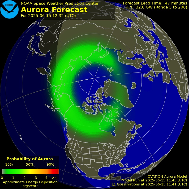
The stargazing score combines cloud cover and moon illumination to estimate how good conditions are for observing the night sky. Cloud cover is the dominant factor — even the darkest location is useless under heavy cloud.
The Bortle scale measures light pollution from 1 (pristine dark sky) to 9 (inner-city sky). In the UK, the best accessible sites reach Bortle 2 to 3, found in areas like Northumberland International Dark Sky Park, parts of the Lake District, Snowdonia, the Brecon Beacons, and the Scottish Highlands. At Bortle 3, the Milky Way is clearly visible and dozens of deep-sky objects are observable with binoculars.
Moon phase matters: A new moon (0% illumination) provides the darkest sky. A full moon floods the sky with light, washing out everything except planets and the brightest stars. The best stargazing combines a new or thin crescent moon with clear skies.
Practical tips: Give your eyes 20 to 30 minutes to dark-adapt after arriving at your spot. Avoid looking at phone screens (use a red-light torch instead). The hours after midnight are often best, as the atmosphere settles and any remaining cloud may clear.
Finding a nearby gauge…
Last reading —
Yellow bars estimate rain since the last reading. Rainfall totals show gauge observations only.
Select a gauge to see its rainfall. Your ground estimate stays centred on Ben Nevis.
Loading nearby gauges…
Explore more forecasts around Lochaber & Glencoe.
Browse other Lochaber & Glencoe locationsPlanning aid, not a safety service. Check official warnings before you go.