
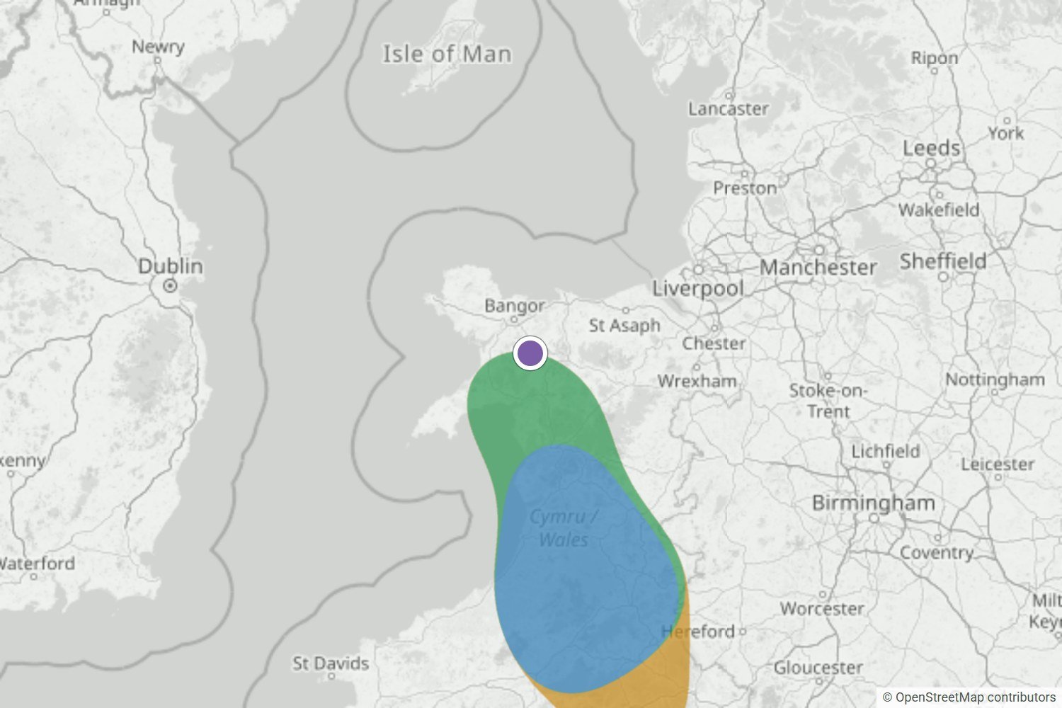
Glyder Fawr to the Bannau, Wales
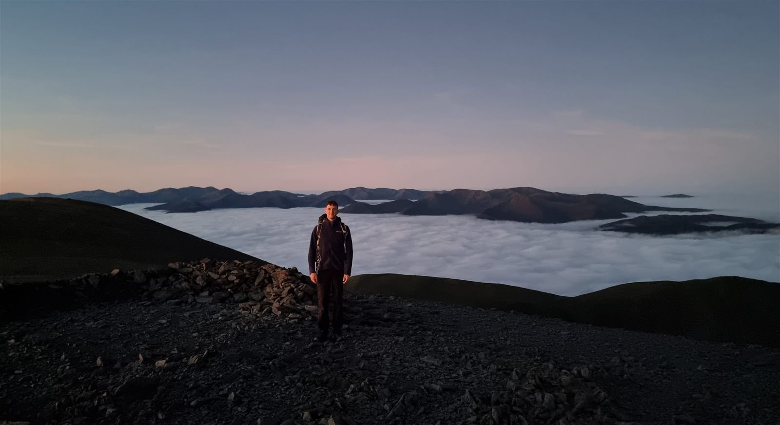
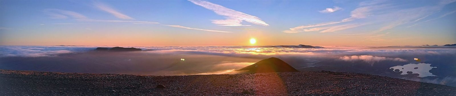
Glyder Fawr was on the edge of a Likely area the night before, and Very likely by morning. The webcam was stuck in cloud, but Morgan and Neil were up above it.
Read the forecast checkA plain-English guide
A cloud inversion is when a layer of warmer air traps cold, damp air in the valleys below it. The trapped air turns into fog or low cloud, and if you’re on a hill above it, you look down on a sea of cloud with clear sky overhead.
How it forms
It takes a clear, calm night and three things happening in order.
On a clear night the ground loses heat quickly and chills the air just above it.
Cold air is heavier than warm air, so it slides downhill and collects in valleys and hollows, a bit like water.
A layer of warmer air above acts like a lid. If the trapped air is damp enough it turns into fog or cloud, and there it sits until the sun breaks it up.

Grey below, sunny above
If you’ve ever driven out of fog on the way up a hill and into bright sunshine, you’ve been through an inversion. The warm lid keeps the damp air and its cloud in a shallow layer near the valley floor, so the valley stays cold and grey while the air above is drier and clear.
The cloud has a flat top because it can’t rise through the lid. That’s what gives you the sea of cloud look, with hills poking through like islands. When there’s no lid and the cloud just keeps going up, you get an ordinary grey day however high you climb.
Know what you’re looking at
From inside the murk they all feel the same. What matters is what’s happening above your head.
| What you’re looking at | What’s happening | Any good for a view? |
|---|---|---|
| Valley fog | Cold air has pooled overnight and its moisture has condensed. | Yes. This is what you want to see below you. |
| Radiation fog | The same process over wider low ground after a clear, calm night. | Often. It tends to burn off as the morning warms up. |
| Hill fog | Cloud sitting on the high ground itself. | No. The summits are inside it, not above it. |
| Haar or sea fog | Damp air drifting in from the coast on an onshore breeze. | Sometimes. The top is often ragged and it moves about. |
| Freezing fog | Any of these in air below freezing, coating everything in rime. | Only from above it. Take care on paths inside it. |
The quick test is the cloud top. A real inversion has a clear ceiling with drier air above it, and the summits sit above that ceiling.
When to look
Mostly in autumn and winter, around dawn, after a clear and calm night. For our UK Cloud Inversion Report we scored 662 mornings in a row at 15 places around the UK. These are forecast scores rather than photographed inversions, but the season stands out.
They’re not impossible in summer, just rarer. We caught good ones in Scotland and Wales in July 2026. And no two seasons are the same: October 2025 was far busier than October 2024.
Read the UK Cloud Inversion ReportWhere to go
You need low ground below you and a hill that rises above the cloud. These are the places people ask about most, each with its own 24 hour forecast.
Somewhere else in mind? Check the forecast for any UK location
Seen for real
I save every forecast before dawn, then check it against dated photos of what actually happened. Here are the latest ones.
Glyder Fawr was on the edge of a Likely area the night before, and Very likely by morning. The webcam was stuck in cloud, but Morgan and Neil were up above it.
Read the forecast check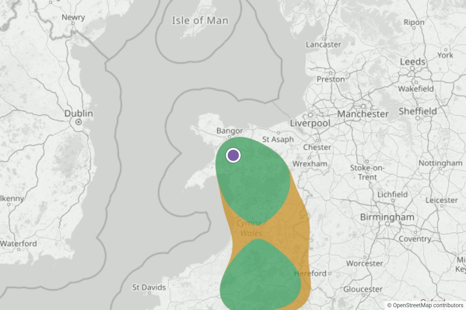
By the night before, Yr Wyddfa was Very likely. The summit webcam and a first-hand report both show it above a cloud sea across Eryri.
Read the forecast check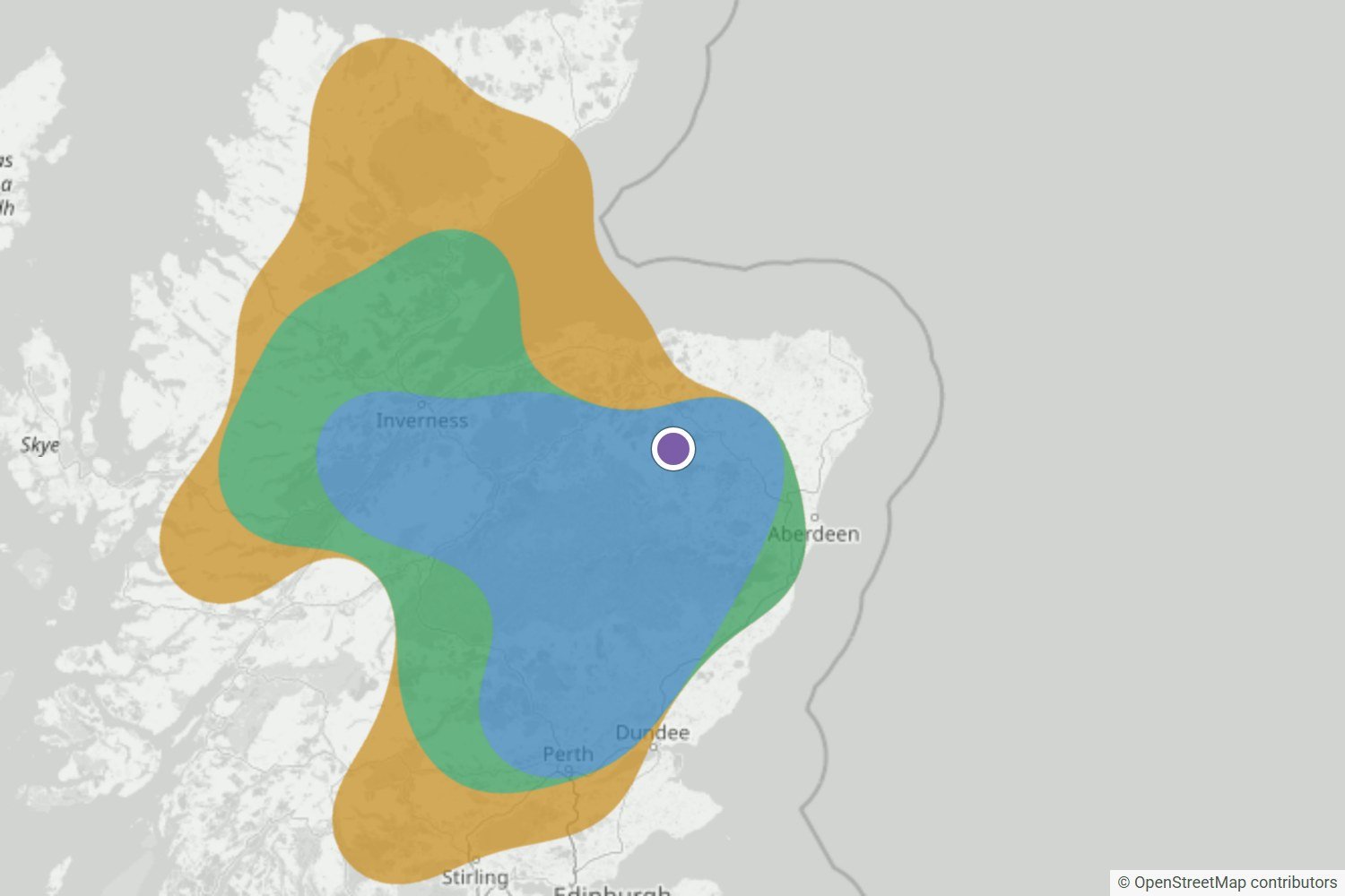
The Very likely area over the Highlands held right up to the final update. Walkers at Tap o’ Noth, Torridon and Loch Quoich found cloud below them at dawn.
Read the forecast checkMisses and uncertain calls get published too, as the record grows.
Browse all forecast checksQuick answers
Not quite. A temperature inversion is the warmer layer of air sitting on top of colder air, and on its own you can’t see it. A cloud inversion is what you get when the cold air underneath is damp enough to turn into fog or low cloud, so the inversion becomes visible.
Usually the hour or two around sunrise. The cold air has had all night to settle into the valleys, and the wind is often at its calmest. Once the sun gets going it warms the ground and stirs the air up, and the cloud tends to thin or lift through the morning.
Above the cloud top, and that changes every time. Some mornings a low hill is enough, other mornings the cloud sits higher than most summits. The WeatherDuck forecast gives an estimate of the cloud top where it can, so you can pick a hill that should clear it.
The view isn’t, but getting to it can be. You’ll often walk up through thick fog in the dark, and in winter that fog can be freezing. Take a head torch, warm layers and a way to navigate in poor visibility, and check the mountain forecast for wind and ice before you go.
Yes, with a bit of honesty about the odds. The clues are a clear, calm night, damp air in the valleys and warmer, drier air above. WeatherDuck checks those for any UK location and gives each morning a band from Unlikely to Very likely. It’s a guide, not a promise, so it’s worth checking again before you set off.
Longer nights give the ground more time to cool, so more cold air collects in the valleys. The sun is weaker too, so it takes longer to break the layer up. Settled high pressure in autumn is the classic setup.
Before you set the alarm
WeatherDuck checks for one every night, for any UK location. The 24 hour forecast is free, and a free account gets you an email when one looks likely.
Check the cloud inversion forecast Get a free alert