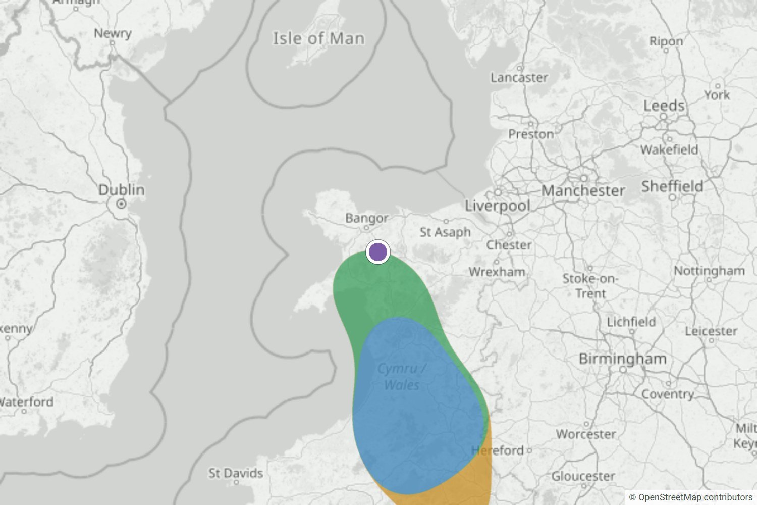
Glyder Fawr to the Bannau, Wales
Glyder Fawr was on the edge of a Likely area the night before, and Very likely by morning. The webcam was stuck in cloud, but Morgan and Neil were up above it.
Read the forecast checkBannau Brycheiniog / Brecon Beacons
Nothing forming around Pen y Fan right now. We’ll email you when that changes.
Captured 20 Oct, 21:07 BST · model rating, not a literal probabilityFree Pen y Fan alert. We email you when a cloud inversion looks likely. No card needed.
Checked against what happened
We save each forecast before dawn, then compare it with dated photos of what happened. The nearest check to Pen y Fan so far is Cadair Idris, about 100 km north.
Glyder Fawr was on the edge of a Likely area the night before, and Very likely by morning. The webcam was stuck in cloud, but Morgan and Neil were up above it.
Read the forecast check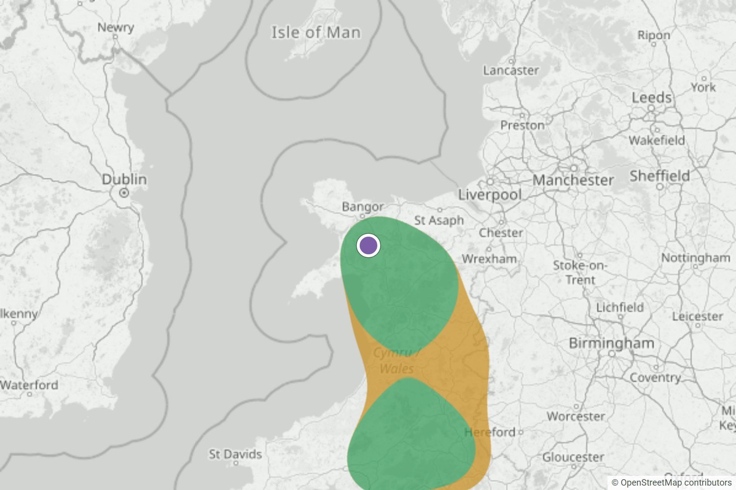
By the night before, Yr Wyddfa was Very likely. The summit webcam and a first-hand report both show it above a cloud sea across Eryri.
Read the forecast check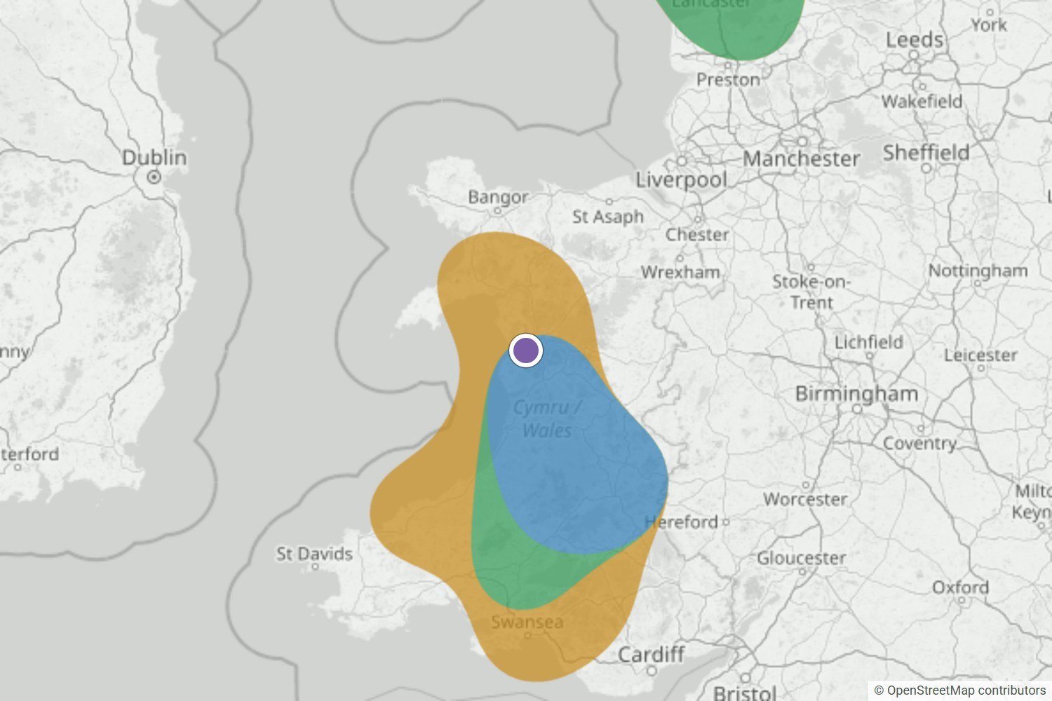
Cadair Idris stayed inside the area in 11 of our 12 updates. Photos from Tyrrau Mawr, other reports and satellite images all point to a cloud inversion across Eryri.
Read the forecast checkWe’ll publish misses and uncertain calls too, as the record grows.
Browse all forecast checksWhat your free alert looks like
When a cloud inversion looks likely near Pen y Fan, WeatherDuck emails you up to 24 hours ahead, so you’ve time to check the route and set an alarm.
 WEATHERDUCK ALERT
Likely cloud inversion
Conditions are lining up for a cloud inversion. Check the latest forecast before you set off.
Example email · values are illustrativeLocal inversion guide
The best chance comes when colder, moist air settles on low ground beneath warmer, drier air, winds stay light and the cloud top remains below your viewpoint.
Pen y Fan stands above the Usk valley, where cold air drains off the Beacons and pools overnight around Brecon and Talybont-on-Usk. The classic cloud sea forms when that valley layer stays below the summit ridge with drier, clearer air above.
Fog along the Usk near Brecon is a good early clue, but depth decides the morning. A shallow pool can leave even the lower ridges clear, while a deeper layer can swallow Pen y Fan and Corn Du completely.
Before you travel: the map shows the wider pattern across Bannau Brycheiniog / Brecon Beacons, not a promise for one summit. Check the latest wind, visibility and mountain forecast for your exact route.
See the forecast data and limitationsLook for warmer air sitting above a colder Usk valley. That lid is what traps overnight fog beneath the summit instead of letting it lift into hill cloud.
Moist air pooling between Brecon and Talybont-on-Usk feeds the cloud sea. Agreement across nearby forecast points beats one isolated fog patch.
The summit needs the cloud top comfortably below it with drier air above. If the layer builds deeper, Pen y Fan can sit inside the murk all morning.
Light winds along the valley help the pool survive the night. Dawn is usually the deepest, calmest moment before heating stirs the layers.
Plan beyond tomorrow
The public map stays focused on the next 24 hours. Premium extends the detailed inversion map, atmospheric profile and forecast window to two days.
Explore more forecasts around Bannau Brycheiniog & Black Mountains.
Browse other Bannau Brycheiniog & Black Mountains locationsQuick answers
No. Valley fog is encouraging, but the cloud top must stay below the summit with clear air above. A deeper layer can cover Pen y Fan and Corn Du completely.
No. The likelihood band is a regional model signal for Bannau Brycheiniog, supported by nearby captured forecast points. Local cloud can still differ from the wider pattern.
No. The outlook describes cloud structure, not wind, ice, visibility or route conditions. Check the full mountain forecast and local guidance before setting out.
Be ready for the next window
We’ll let you know when conditions look promising, so you can check the latest map and mountain forecast before deciding.
Create my free alert